Little Campbell River Watershed
The Little Campbell River watershed is located at the centre of the Salish Sea (or Georgia Basin-Puget Sound Ecoregion) and runs from Langley in the east, through South Surrey and into White Rock where it enters Semiahmoo Bay.
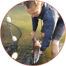
This river and its surroundings are characterized by unchannelized streams, an undyked floodplain, an undeveloped estuary, and several large wetlands. The Little Campbell River watershed is home to five species of salmon and trout, and a number of endangered species. Despite these qualities, the watershed is facing pressure just like other watersheds in the larger Salish Sea and suffers from poor water quality, low water levels during the summer, loss of wetland habitat and loss of forests due to urbanization and agricultural development.
An Endangered River
Interactive Watershed Map
Click around the map to learn more about the Little Campbell River Watershed. To navigate between the different topics on the map, use the tool bar at the top right of the map.